Track on one dataset, segment on another
tobac also has the capability to combine datasets through Segmentation, which includes the ability to track on one dataset (e.g., gridded radar data) and run segmentation on a different dataset on a different grid (e.g., satellite data).
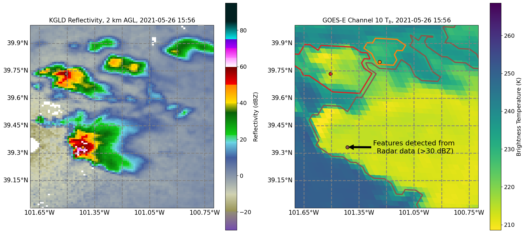
To do this, users should first run Feature Detection Basics with a dataset that contains latitude and longitude coordinates, such that they appear in the output dataframe from Feature Detection. Next, use tobac.utils.transform_feature_points() to transform the feature dataframe into the new coordinate system. Finally, use the output from tobac.utils.transform_feature_points() to run segmentation with the new data. This can be done with both 2D and 3D feature detection and segmentation.