Track on one dataset, segment on another#
tobac also has the capability to combine datasets through segmentation, which includes the ability to track on one dataset (e.g., gridded radar data) and run segmentation on a different dataset on a different grid (e.g., satellite data).
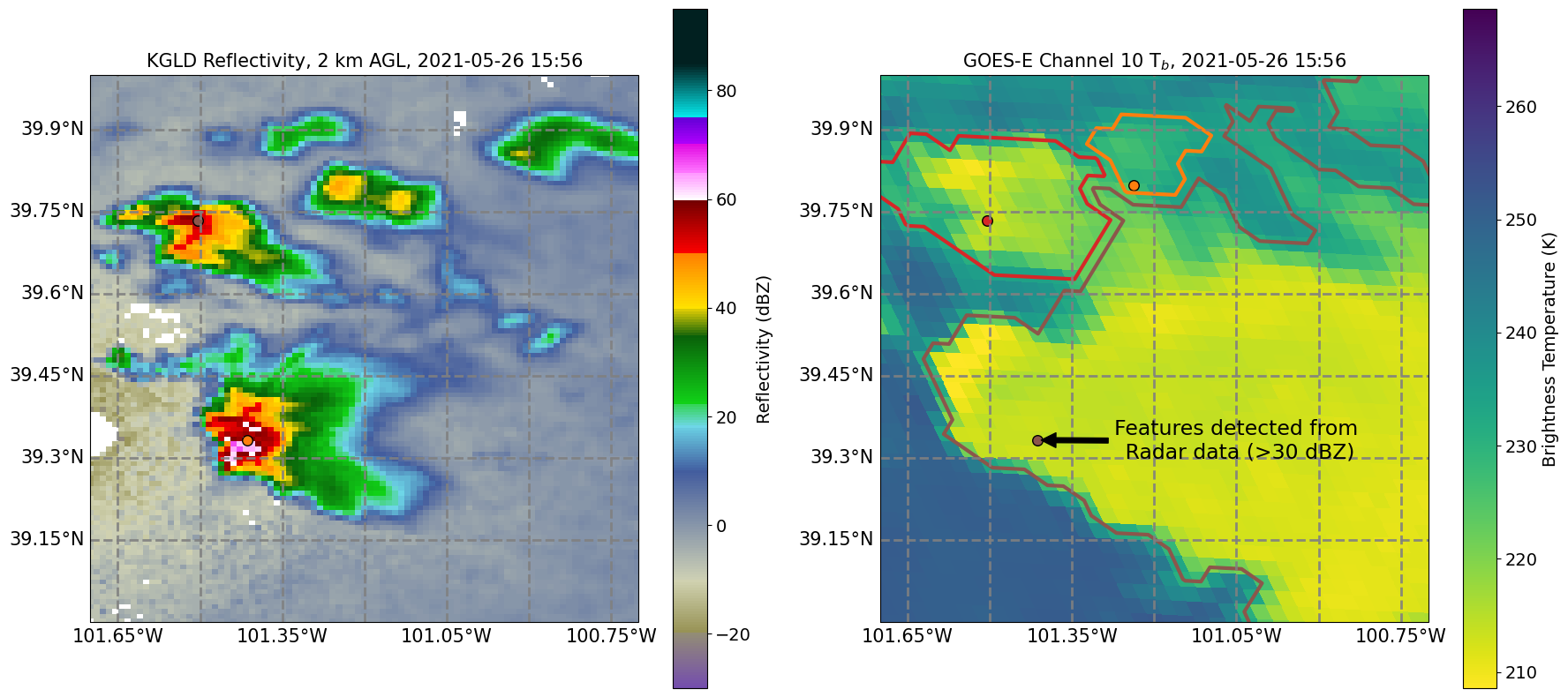
To do this, users should first run Feature Detection with a dataset that contains latitude and longitude coordinates, such that they appear in the output dataframe from Feature Detection. Next, use tobac.utils.transform_feature_points() to transform the feature dataframe into the new coordinate system. Finally, use the output from tobac.utils.transform_feature_points() to run segmentation with the new data. This can be done with both 2D and 3D feature detection and segmentation.